NavVis VLX3: Macleod Simmonds acquires the industry-leading 3D laser scanner
16 January 2025 by: Macleod Simmonds
Macleod Simmonds is excited to share news on our latest investment, the unique and unmatched NavVis VLX3. We believe the NavVis VLX3 to be the fastest and most comprehensive mapping/ asset management tool available anywhere in the world.
What will be highly beneficial to our clients is that this cutting-edge piece of equipment can capture detail in minutes that previously could have taken days.
What are the main benefits of the NavVis VLX3:
Reduces time spent surveying site
The NavVis VLX3 3D laser scanner will enable us to collect data on site far quicker than would be possible using conventional methods. It can quickly scan an entire site preserving original details and removing dynamic objects like traffic. The easy-to-operate device means we can deploy the solution at short notice so we can help our clients with even the most urgent projects.
Next day access to the data captured
Whilst Macleod Simmonds has always been able to deliver the best quality data using our intelligent methodologies, the level of detail meant this could not always be done at speed. The NavVis VLX3 enables us to process and upload the data, in most cases, providing useable access to the information, the very next day.
Unmatched precision, accuracy and level of detail
Compared to other surveying solutions, the NavVis VLX3 enables us to deliver comprehensive, highly detailed reality capture data like never before. The NavVis VLX3 workflow reduces human error and obstructions, ensuring quick data collection without compromising on accuracy.
Some of the most impressive features include:
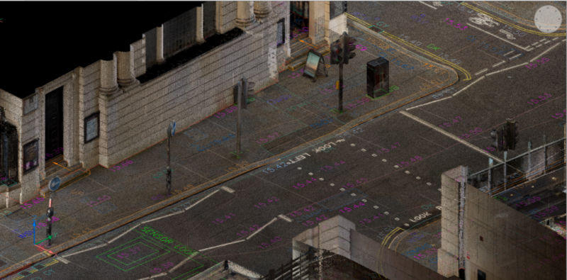
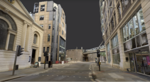
- 3D point cloud imagery is nearly as clear and detailed as if you had taken a photograph.
- Measurements, including areas and coordinates, can be taken directly from the imagery.
- Captures such as floorplans, elevations and topographical surveys are more detailed than ever before.
Cost-effective
Due to its speed and accuracy, surveys undertaken are very cost-effective. Furthermore, it can give you more data than ever before; meaning one NavVis VLX3 survey can replace multiple surveys using other equipment.
Reusable data
The extensiveness and level of detail means you can potentially use the data again in the future. It also negates the need for additional work or surveys to be undertaken on projects. For example, a quantity surveyor or estimator could draw a simple outline on the data to assess the quantity of paving slabs needed to cover a specific area of pavement without leaving the office nor requiring a CAD model topographical survey.
Client access to the portal
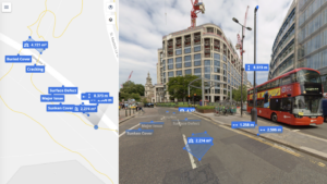
Every client receives their own login where they can manage and explore the data.
It has some of the most impressive functionality we have ever seen:
- You can create your own categories for interesting features e.g. bollards, which you can then pick from the data set.
- Point cloud data can be exported to other software suites where the data can be used to create building elevations and topographical surveys.
- Information can be easily shared with colleagues and multiple teams via email or PDF. Media such as voice notes, documents, images and videos can also be attached.
- Limit ambiguity by all teams working from the same dataset.

What types of surveys can you undertake with the NavVis VLX3
The virtually instant access to the data once collected, uploaded and processed, allows for very quick pre-and-post construction assessments. It allows key measurements, elevations and coordinates to be extracted and shared, along with points of interest, material areas and potential hazards or defects. All picked entities can be associated with documents, pictures, data files or videos and imported directly into existing GIS platforms. The data can be associated and worked on within Revit to facilitate BIM works, and relevant data can be extracted to create measured floor plans, building elevations, building sections or external topographical surveys.
The NavVis VLX3 saved 68% per square metre in BIM modelling costs at Amsterdam Schipol Airport when building a digital twin. It also scanned 490,000 square feet in just 108 minutes whilst undertaking an urban road project in Los Angeles.
Book a free demo
Craig and the Macleod Simmonds team would love the opportunity to give you a virtual demo of the NavVis VLX3 scanner and the Ivion online web portal.
Book a Demo
